Maps of Lebanon
Lebanon Maps (University of Texas at Austin Map Collection)
Lebanon - Clickable Maps in Arabic and English (AUB)
Country Maps
Lebanon
(Political) 2000 (235K)
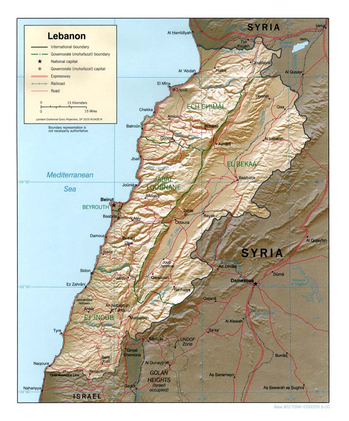
Lebanon
(Shaded Relief) 2000 (269K)
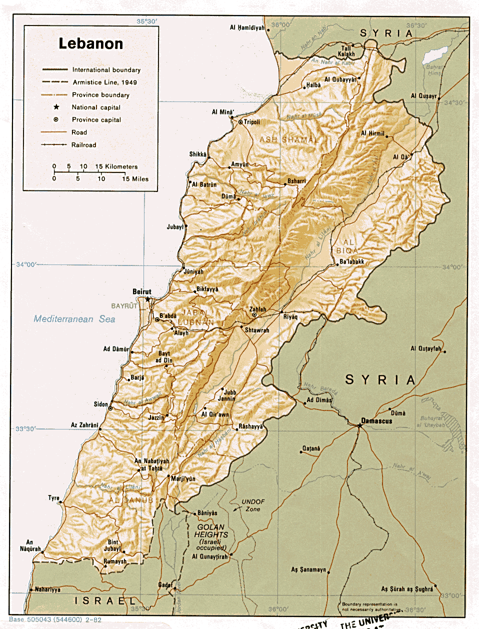
Lebanon
(Shaded Relief) 1982 (283K)
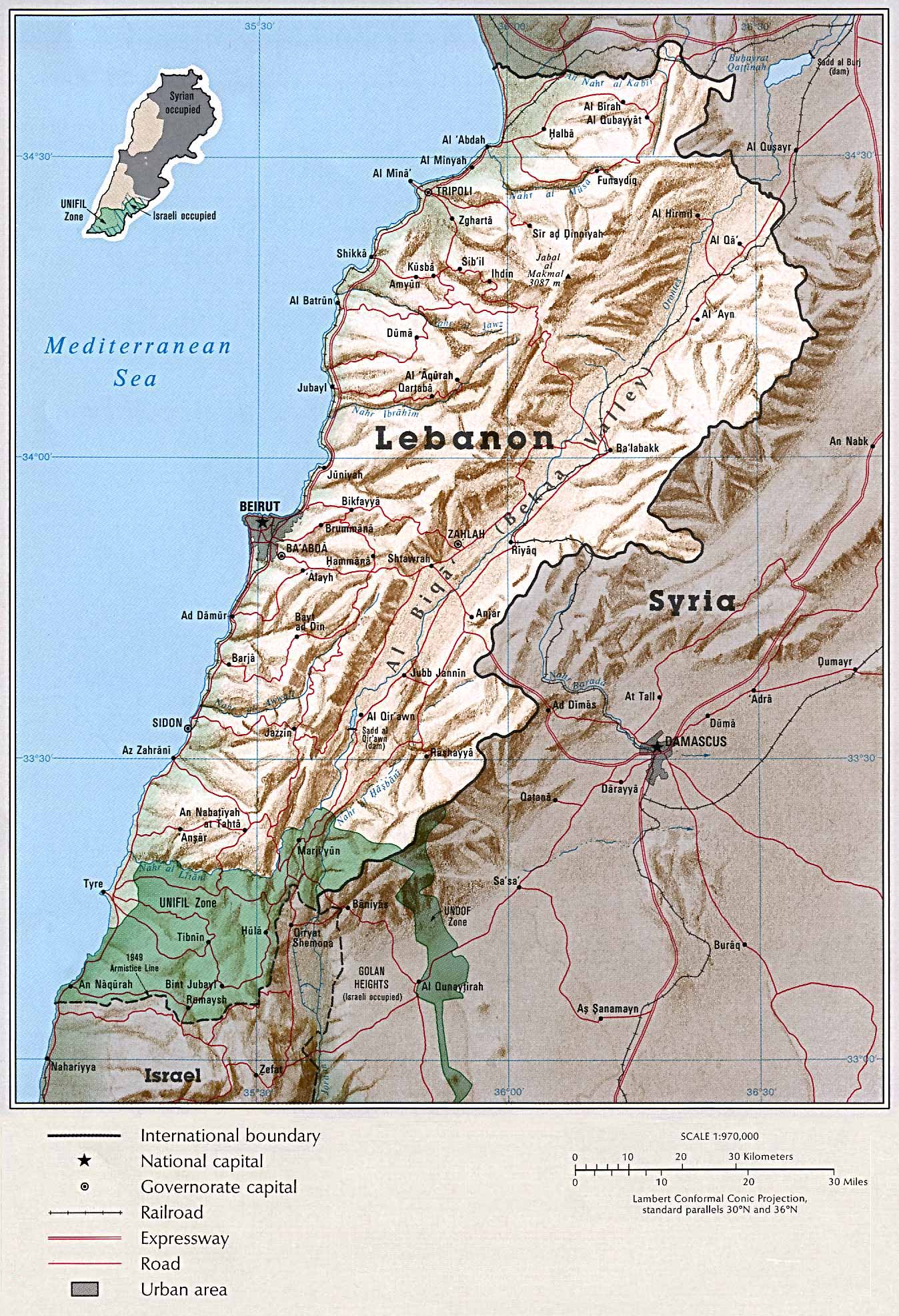
Lebanon
(Shaded Relief) From Atlas of the Middle East 1993 (604k)
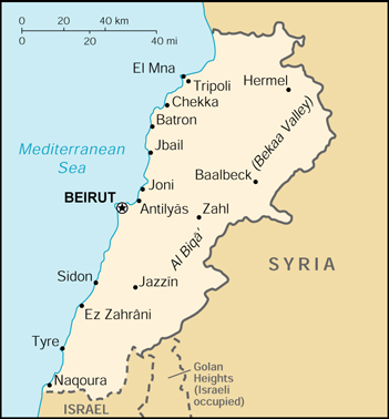
Lebanon
(Small Map) 2001 (82K)
City Maps
Beirut
1980 (249K)
Historical Maps
Beirut [Beyrout] 1912
(737K) From Palestine and Syria...Handbook for Travellers by Karl Baedeker, 5th Edition, 1912
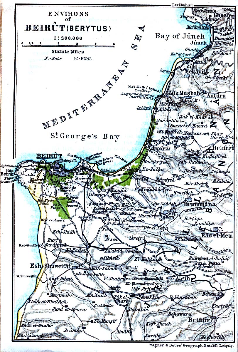
Beirut Environs 1912
(346K) From Palestine and Syria...Handbook for Travellers by Karl Baedeker, 5th Edition, 1912
Sidon [Saida] Environs 1912
(290K) From Palestine and Syria. Handbook for Travellers by Karl Baedeker, 5th Edition, 1912
Tyre [Sur] Environs 1912
(240K) From Palestine and Syria. Handbook for Travellers by Karl Baedeker, 5th Edition, 1912
Thematic Maps
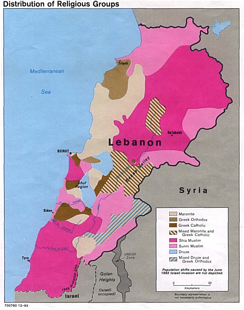
Lebanon - Distribution of Religious Groups
1983 (190K)
Lebanon - Administrative Divisions
From Atlas of the Middle East 1993 (64k)
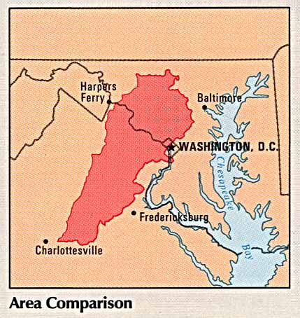
Lebanon - Area Comparison
From Atlas of the Middle East 1993 (50k)
Lebanon - Country Information
From Atlas of the Middle East 1993 (93k)
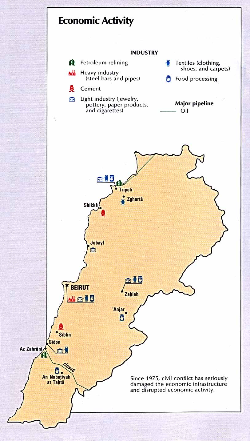
Lebanon - Economic Activity
From Atlas of the Middle East 1993 (148k)
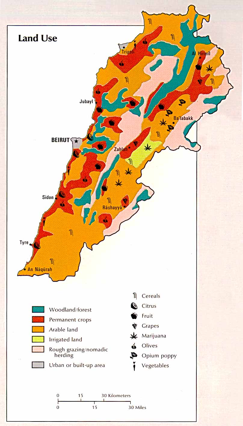
Lebanon - Land Use
From Atlas of the Middle East 1993 (126k)
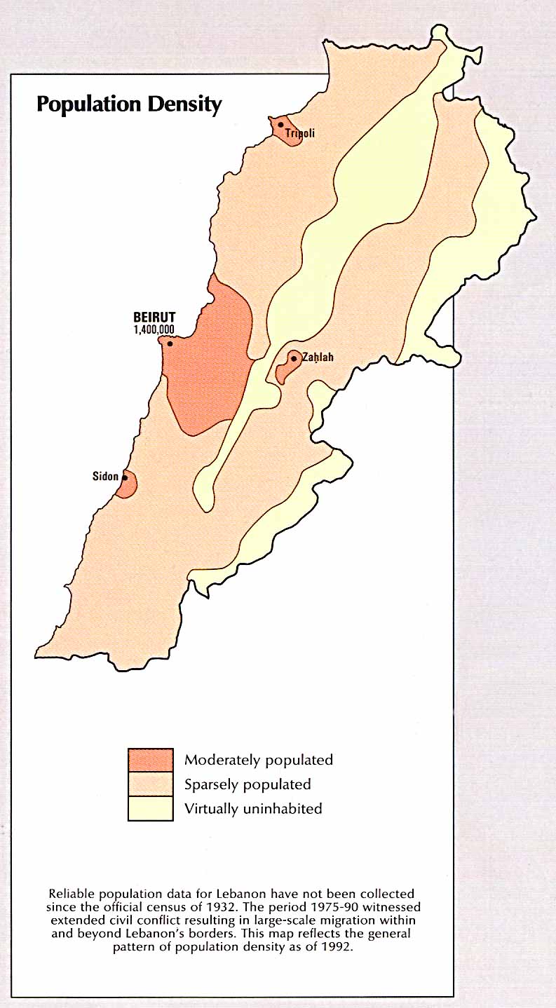
Lebanon - Population Density
From Atlas of the Middle East 1993 (119k)
Related Maps
Middle East Maps
![Beirut [Beyrout] 1912](http://www.lib.utexas.edu/maps/historical/beirut2_1912.jpg)
![Sidon [Saida] Environs 1912](http://www.lib.utexas.edu/maps/historical/sidon_1912.jpg)
![Tyre [Sur] Environs 1912](http://www.lib.utexas.edu/maps/historical/tyre_1912.jpg)